Fall event 2018/3 - Marscherwald, Graulinster
November 25th
The deadline for entries is on Friday 23rd of November at 0:00.
6 said to be going to the event.Tell the organizer that you're coming
Log in to tell whether you go, or not.
Events organized by the club: To ease communication with the organizers of an event organised by LuxOC, register using the "going there" button on the event page. Drop a note to let others know some details. See who's going and their notes by clicking "review details".
Events organized by other clubs: Unless specified otherwise, the club does not register for events organized by others. The "going there" button serves to tell others that you're coming, for instance to ease car-sharing.
In your profile (link on top of the page) give your family or friends the right to say "going there" on your behalf.
Contact: Balian Martinez
- LuxOC organisation training
- 6
- 6
- November 25th, 2018 09:29 – 12:29 google ical
-
Blumenthal, Canton Echternach, 6240, Luxemburg
Geo coordinates
- geo:49.744228,6.281605 (open in a phone navi app)
- 49° 44' 39.2" N 6° 16' 53.8" E
- 49° 44.65 N 6° 16.9 E
- OpenTopoMap
- Google Maps
Location
- Northern end of Marscherwaldweg (Rue de Marscherwald) in Graulinster.
- Car: 20 km from Luxembourg City towards Echternach, take RN11
- Bus number 111 leaves Sunday morning at 9.23 AM from Lux-Gare Central, arrives at 10.00 AM. Stop: Graulinster, Haaptstrooss. 800 meters walk.
- Please check the map!
Start
- Between 10.00 and 12.30
Terrain
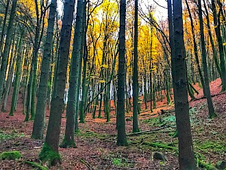
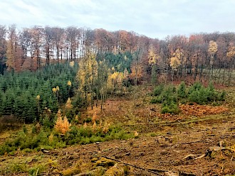
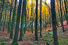
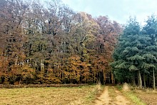
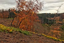
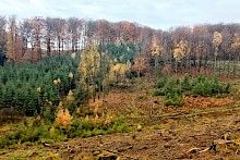
Rocky formations, steep but shallow valleys, forest with mixed runnability and visibility. Some forest works have been conducted recently. Orienteering shoes are recommended.
Map
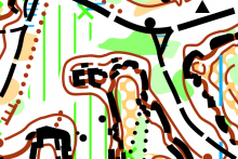
A4 size, scale 1:10 000, contours 5 m. Surveyed in 2014, updated in 2017 and November 2018.
I can give some plastic cases for the maps if the weather turns rainy but if you can, please bring your own.
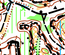
Final course information (updated 20.11.2018)
| Course | Length | Climb | Controls |
|---|---|---|---|
| Long | 8.0 km | 190 m | 24 |
| Medium | 5.6 km | 130 m | 19 |
| Short | 2.3 km | 55 m | 7 |
| Tiny | 1.2 km | 20 m | 4 |
| Long Technical* | 8.0 km | 190 m | 26 |
| Medium Technical* | 5.3 km | 165 m | 18 |
| Short Technical* | 3.0 km | 85 m | 10 |
| Tiny Technical* | 1.9 km | 30 m | 7 |
*contours-only map
The control descriptions are printed on the map.
Entry
Free for all but if possible, sign up before 23 November here on the page or send me an email to balazs.duhi@gmail.com. I prepare some extra maps for those who are showing up on the day.


Comments
julien 7 years ago
Hi Balasz. I'll go for the long one. Thanks for organising !!!
Reply
balazsd 7 years ago
great, see you there!
however I'll convince you to do the technical version ;)
Reply
julien 7 years ago
In fact, I would prefer to do the normal one, with the full map - No corridor - No memo, just a normal course. Is it possible?
Reply
balazsd 7 years ago
hehe no worries, it's a full map but only the brown colours remained.
but you can get a "taste" on the tiny technical course as a warm-up :)
Reply
Stefano 7 years ago
Hi, if still possible I would also like to join the event, for the long course.
Thanks a lot for organizing this!!
Reply
balazsd 7 years ago
Hello, absolutely, see you tomorrow!
Reply