Fall event 2018/4 - Northern Luxembourg
December 9th
The deadline for entries is on Thursday 6th of December at 23:59.
9 said to be going to the event.Tell the organizer that you're coming
Log in to tell whether you go, or not.
Events organized by the club: To ease communication with the organizers of an event organised by LuxOC, register using the "going there" button on the event page. Drop a note to let others know some details. See who's going and their notes by clicking "review details".
Events organized by other clubs: Unless specified otherwise, the club does not register for events organized by others. The "going there" button serves to tell others that you're coming, for instance to ease car-sharing.
In your profile (link on top of the page) give your family or friends the right to say "going there" on your behalf.
Contact: Ondřej Kotecký
- LuxOC organisation training
- 6
- 9
- December 9th, 2018 10:30 – 11:30 google ical
-
CR 347, Ermsdorf, Schieren, Canton Diekirch, 9132, Luxembourg
Geo coordinates
- geo:49.832073,6.123741 (open in a phone navi app)
- 49° 49' 55.5" N 6° 7' 25.5" E
- 49° 49.92 N 6° 7.42 E
- OpenTopoMap
- Google Maps
Courses
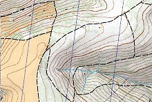
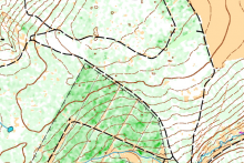
Expect an event with longer courses. Suitable for both adults and confirmed or accompanied children: the shorter course will be designed half-easy, half-difficult and adults may choose to take it as a joint venture with their offsprings to run together and show some good habits of orienteering. Lidar based computer-generated orienteering map.
Venue
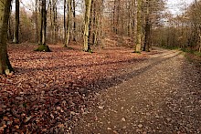
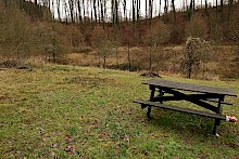
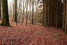
It is possible to come by train to Schieren and walk up 2.2 km. From the train station find and follow the rue Lehberg along the valey. If not, park your car by the forest road south from the map marker. We will meet at photo two if the weather is good, at marker. If not, we stay at cars.

Comments
Brigitta 7 years ago
Hi there,
Robert and I are coming :) Thanks and see you soon.
Cheers.
Reply
balazsd 7 years ago
Hello,
If anyone is in a need of ride: I leave at 9.45 from Howald (can pick up at Gare)
just message me :)
Reply
ondra 7 years ago
I enjoy the combination of modern and archaic, of pub-based cartography relying on computer generated data. One remote approach established in the eighties by the Czechs around Jéňa Šváb, and learned, elaborated and vastly practiced by the Finn Hannu Mähönen in the nineties. The other, rather sober, remote by definition, developped by Jarkko Ryyppö recently.
Reply
orsi 7 years ago
Hmm, I'm curious to hear more about pub-based cartography! Is it mapping all the pubs in the area? :-)
Reply
ondra 7 years ago
Nope, the other way round.
Reply
balazsd 7 years ago
I wish I understood your words. Please teach me! :)
Reply